How Did the Treaty of Versailles Change the World Map?
The Treaty of Versailles radically reorganized the map of Europe, to the detriment of the German Empire, and restructured many of Germany’s former overseas colonies. In every case, Central Power nations lost territory, and Allied nations gained territory, although some colonies were transferred to international control, and a number of European countries became independent.
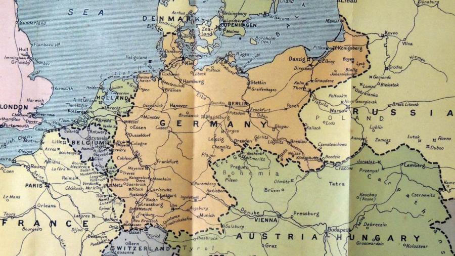
In Europe, where the most dramatic adjustments took place, Germany lost 27,000 square miles of territory, 13 percent of its land area, to its neighbors. In the west, Germany ceded Alsace-Lorraine to France and a small area of land to Belgium. In the north, Germany lost the upper section of the Kiel peninsula to Denmark. In the east, the new nations of Poland and Czechoslovakia gained territory from Germany and Austria.
The Austro-Hungarian and Ottoman Empires, which fought alongside Germany, were completely dismantled in favor of small ethnic states such as Bulgaria and Hungary. In addition, Germany temporarily lost control over the Saar and the Rhineland.
Overseas, Germany’s territories were parceled out among the victorious Allies. German West Africa merged with British South Africa, and German East Africa was likewise acquired by Britain. In the Pacific, all German territories north of the equator went to Japan, and those south of the equator were assigned to Australia.


