What Are the Geographical Features of Japan?
Japan is an island nation in East Asia. It is an archipelago consisting of 6,852 islands in total. It is bordered by the North Pacific Ocean, Philippine Sea, East China Sea and the Sea of Japan. The four Home Islands, Hokkaid?, Honsh?, Shikoku and Ky?sh?, comprise about 97 percent of the country’s land mass. The capital city of Tokyo is located on Honsh?.
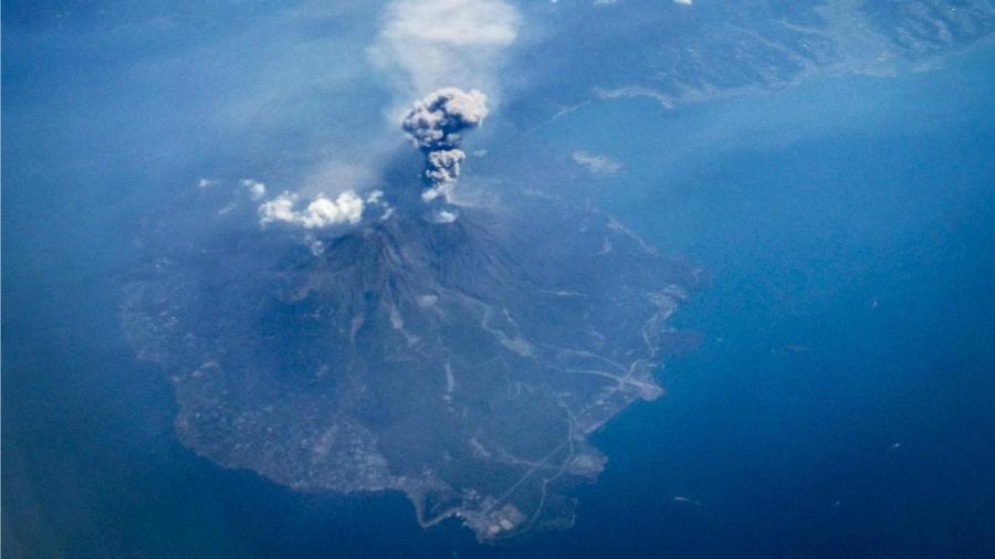
Mountains and forests cover approximately 72 percent of Japan. The highest elevation in the country is Mount Fuji, located on Honsh?, whose peak is at 12,388 feet above sea level. Other major mountains in the country include Mount Tate and Mount Haku. The Hida, Kiso and Akaishi Mountains are part of the Japanese Alps, with Mount Kita having the highest peak in this range. Japan also has 108 active volcanoes.
The Shinano River is longest river in the country. The largest lake is Lake Biwa. The lowest elevation is found at Hachir?gata, which was the second-largest lake in the country until land reclamation began in the 1950s. The lake’s elevation is four meters below sea level.
The coastline in Japan is 18,486 miles long. Most of the land suitable for habitation and cultivation lies along the coasts.